
Where We Be
| | | | | | |
| Maps & Itinerary: Caribbean + Bermuda |
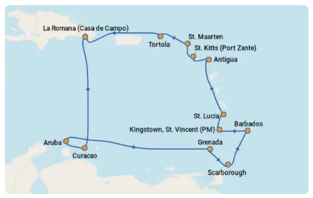
The original impetus for this trip was the desire
to check off five new UN-recognized countries
with minimal effort -- specifically, the Dominican
Republic (i.e., La Romana on the map at left),
Grenada, Trinidad & Tobago (i.e.,Scarborough),
St. Vincent & the Grenadines, and St. Lucia. For
reasons of their own, Norwegian Cruise Lines
decided to alter the itinerary after final payment
was due, eliminating three of the ports of call
we cared about (Grenada, T&T, and St. Vincent).
Their rationale? Fuel efficiency. (Really, NCL?)
Their replacement ports of call were Catalina
Island (just offshore from La Romana), Bonaire
(close to Curacao), and a day at sea. To be
honest, this felt like bait-and-switch tactics to
us, and it made us realize cruises may not be
the best way to check off new countries, since
itineraries can change at the drop of a hat.
In the end, we enjoyed ourselves despite the
changes. We still got to see the Dominican
Republic and St. Lucia (both new to us) and
experience a fun southern Caribbean cruise --
just not the one we had expected or paid for.
| Our original cruise itinerary, revised by NCL after final payment was due (not cool, NCL) |
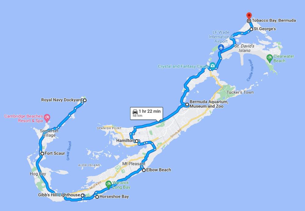
| Bermuda Map |
| The above map shows my original -- and perhaps overambitious -- moped route to explore the entire island. In the end, we only took the moped from the Royal Dockyards to Elbow Beach, which was plenty. That part of the island is quieter and less trafficked. The rest of Bermuda we explored by ferry and bus. |
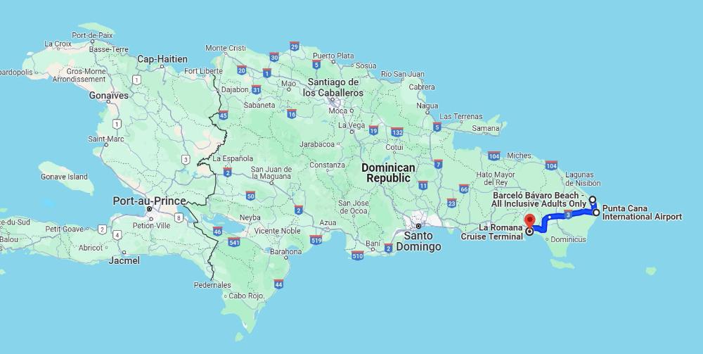
| Dominican Republic Map |
| Figure on about 1 hour to get from Punta Cana Airport (PUJ) to La Romana cruise port by taxi / transfer. Flying into PUJ makes the most sense if your goal is to visit one of the all-inclusive resorts in Punta Cana. |
| Map data ©2024 Google |
| Map data ©2024 Google |