
Where We Be
| Longs Peak, Colorado |
| | | | | | |
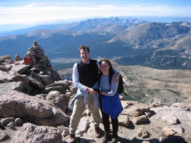
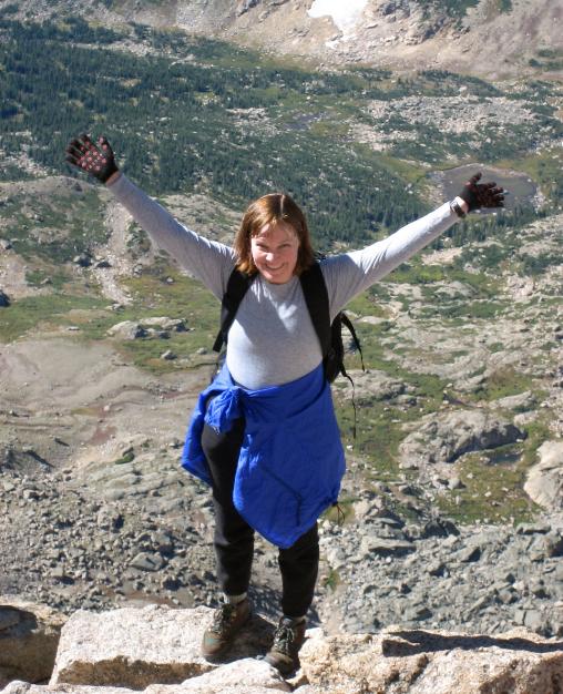
| Whew! We made it! Celebrating at the summit of Longs Peak |
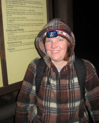
| A head lamp is essential since you start the hike pre-dawn |
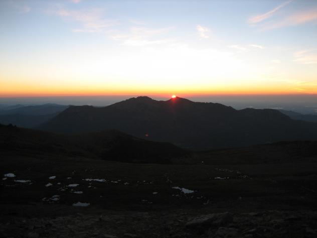
| Sun peeking over mountains to the east |
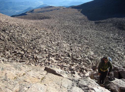
| Sunlight draws a sharp line across the Boulder Field |
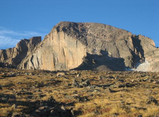
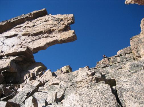
| The Diamond -- a sheer pyramid-shaped slab of rock on the east side of Longs |
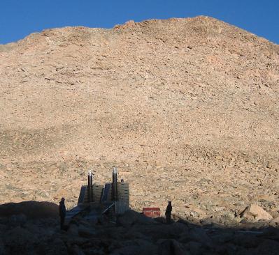
| Restroom facilities at 12,000+ feet |
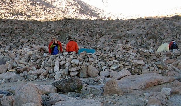
| Some split the hike in two and pitch their tents in stone "forts" to escape the intense wind |
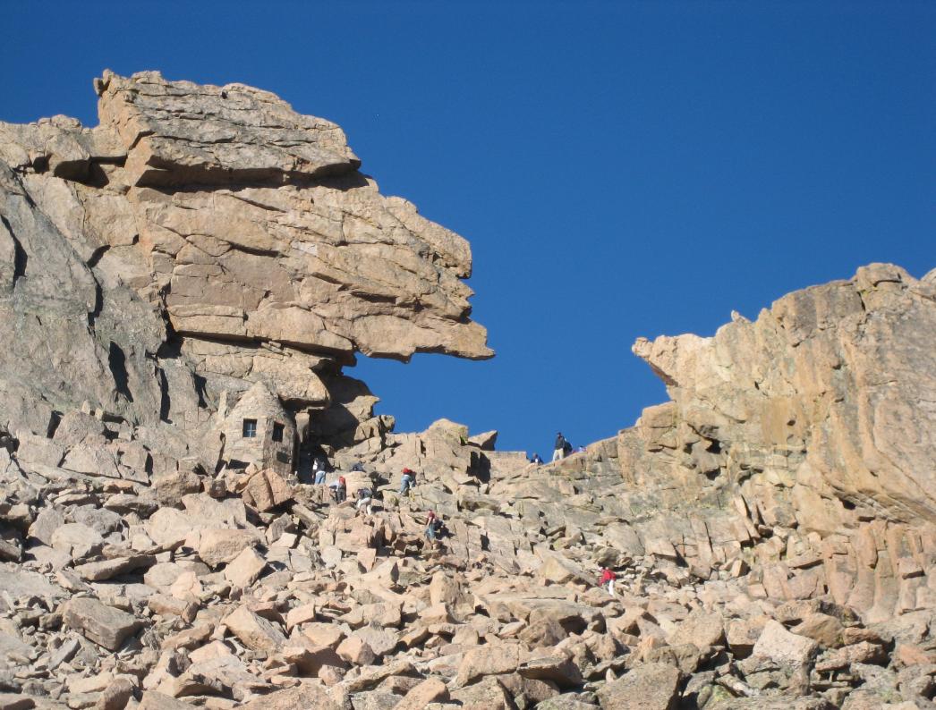
| This is the Keyhole. Getting to this point is an accomplishment in itself, and many turn around here once they see what awaits them on the other side. |
| ASCENT TO THE KEYHOLE: We start hiking at 4 am beneath an amazing starscape, see the sun rise, and arrive at the Keyhole by mid-morning |
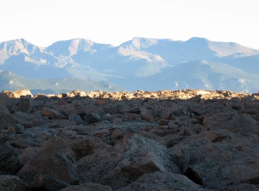
| Looking back at the desolate moonscape views of the Boulder Field |
| The Keyhole up close, looking like it might come crashing down at any minute |
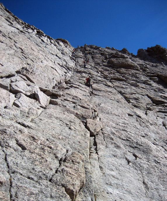
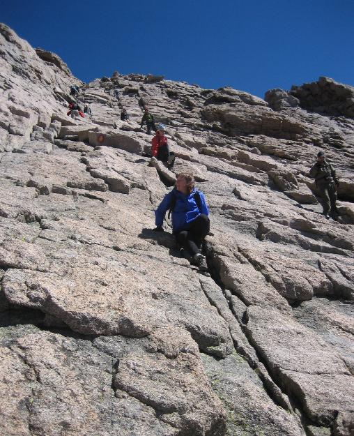
| THE LAST MILE (IT'S A DOOZY!): The ultra-steep Trough nearly does us in, but we make it, then pick our way along the Narrows to the Home Stretch |
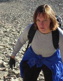
| Robin struggles at the Trough |
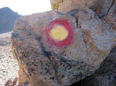
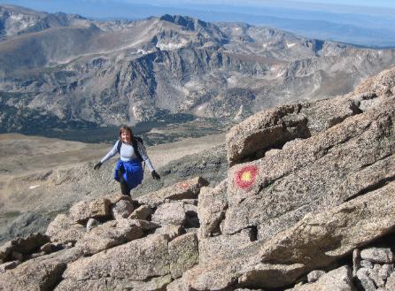
| Just follow the red-and-yellow bulls' eyes |
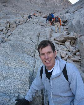
| Bob near the base of the Trough |
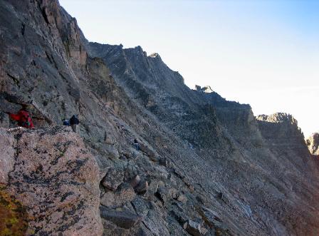
| Hikers hug the rock wall along a section of the Narrows |
| The ultra-steep Home Stretch -- the summit is just...up...there |
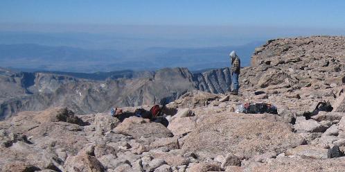
| THE SUMMIT!: After 8 long miles of uphill slogging and 5,000 vertical feet of elevation gain, we're more than ready for a rest! |
| That smile says it all! |
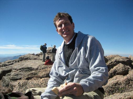
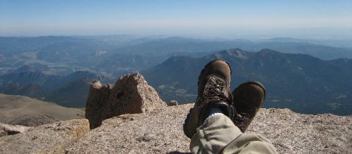
| Put your boots up, have a sandwich, enjoy the world below you |
| Euphoric after making it to the top |
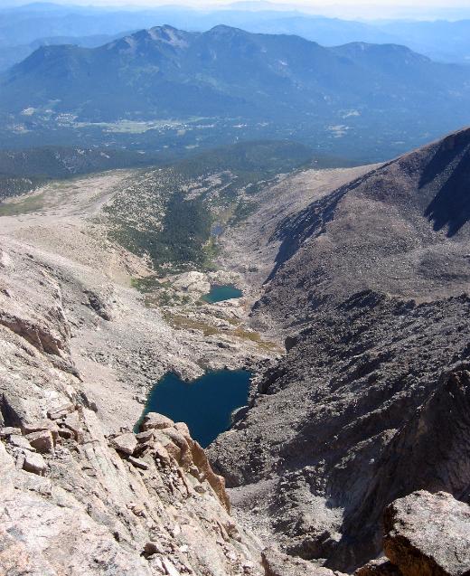
| The view down to Chasm Lake (and two other lakes as well) |
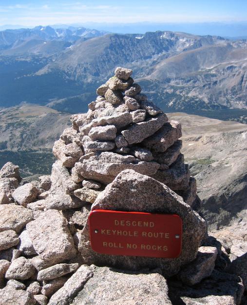
| "Roll No Rocks" -- one danger is rocks dislodged by careless hikers above you |
| Robin crab-crawling down a particularly steep section of the Home Stretch |
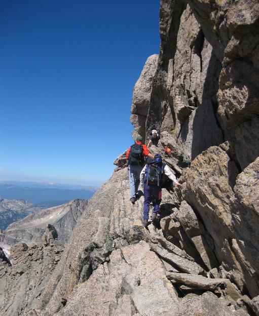
| It looks worse than it is--really! We wait our turn to cross a section of the Narrows |
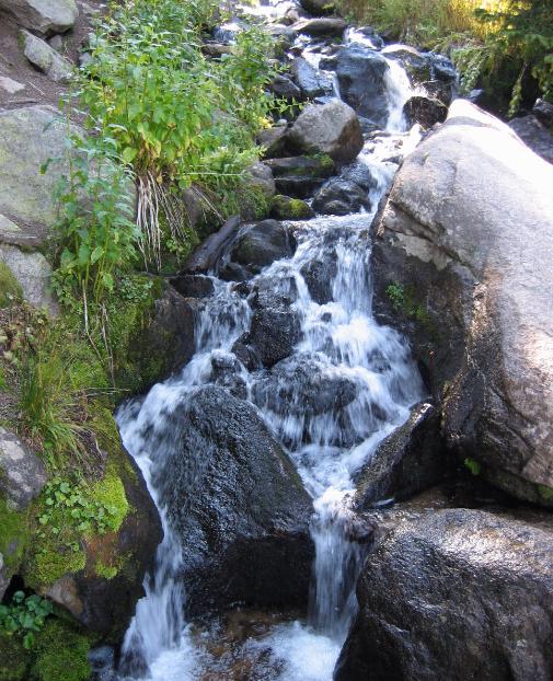
| You know you're close to the end when you see rushing streams like this again |
| LONGS PEAK |
September 3, 2006
Well, we made it! It wasn't easy, it wasn't pretty, but Robin and I made it to the top of Longs Peak.
Man, that's a long hike.
Getting Started
We postponed our hike by one day due to drizzly weather and were glad we did, because Sunday
turned out to be an absolutely perfect day. The forecast looked so promising that we agreed to
wake up a bit later than normal for a Longs Peak hike (e.g., 2:30 instead of 1:30 am) and begin
hiking at 4 am instead of 3 am.
When we reached the trailhead parking lot, it was already full but we were able to find a spot on
the side of the road just a few yards from the lot. (Later in the day, when we returned, there were
cars parked all the way down the roadside for nearly half a mile.)
First 6 Miles
We signed the logbook at the trailhead and started hiking in darkness at 4 am. It was cold (about
30 degrees), and we had every stitch of clothing on that we had brought with us. I wore my
convertible pants, a long-sleeve shirt, black hiking vest, hooded sweatshirt, fleece jacket, and
raingear top plus cap and gloves. The starscape above us was incredible. We turned our
headlamps on and started hiking up the trail.
The first two miles are along a wide dirt path through the forest, so the hiking is easy even in
darkness. The trail slopes slightly uphill but the going is a breeze. After the first hour or so, we
reached treeline, and the entire rest of the hike was exposed. It instantly got colder and windier
once we left the trees; I put my hooded sweatshirt and cap back on for the next two miles.
We could see headlamps ahead winding up the mountain. We covered another two miles by the
time the sun came up around 6 am. We got passed by twenty-somethings setting a harder pace
than we felt comfortable with, but that was okay. We were making good, steady progress and
would later pass some of them at the boulder field and beyond.
The Boulder Field
We reached the boulder field—a seemingly endless expanse of jumbled granite—at 7 am; this
was steeper than I had remembered it. I had thought it was more or less level, but it actually
climbs quite a bit, so we picked our way slowly across the boulders, watching the Keyhole grow
bigger and bigger in front of us.
The Keyhole
We reached the Keyhole before 8 am and snugged right up against the top, resting on a ledge
and letting the sun warm us up before crossing over to the other side where it was still shadows
and cold. We ate half our sandwiches in the sun and enjoyed the amazing moonscape views of
the boulder field we had just crossed.
We passed through the Keyhole. As I noted in my last Longs Peak entry—almost ten years ago to
the day (9/10/96)—“When you look over the other side you’re rewarded with a stunning—and
terrifying—panorama of mountains spread out below you, with apparently nowhere to go. But as
you crest the Keyhole you see a narrow path hugging the left side of the rock face. You cross this
very carefully, following the red-and-yellow bulls-eyes used to mark the trail.” We picked our way
along carefully with no real problems. The trail actually descends for a time before starting to
climb again.
The Trough
Before long, we reached the “Trough” and struggled up the steep and seemingly endless slope.
You can see the top of the Trough way up above you. Those little things crawling up there are
people, not ants. It’s a bit demoralizing. You claw your way up what feels like a 45-degree slope
strewn with loose scree and talus. This was Robin's least favorite section of the hike, and the only
time she considered giving up. She was pushing right up against her physical limits. Her heart and
head were pounding with the effort (as were mine). Negotiating this slope at 13,000+ feet is taxing
to say the least, and just about everybody struggles with it. More than once near the top, we
reached a logjam and had to wait for people ahead of us to pull themselves up a steep “giant’s
step,” a narrow bottleneck, or a challenging crevice. None of it was technical per se, but it did
involve using your whole body to pull yourself up and over (or around) some tricky spots.
The Narrows
It was with a great sense of relief that we finally reached the top of the Trough and Robin’s smile
suddenly broke through like sunshine through clouds. “This is so worth it!” she enthused as we
hiked along the aptly named Narrows. This section is the scariest part of the hike for many
people; we spoke to one couple who had to turn back at this point because, in the guy’s words, “It
was more than I bargained for.” If you have a fear of heights, it could certainly seem treacherous,
since there are sheer dropoffs of 1,000 feet or more, but we found these “scary” parts some of
the most invigorating and enjoyable of the hike. The Narrows is mostly flat and the hiking
relatively easy (at least in good weather); you hug the wall to your left and look out at some
absolutely stunning views below you and to the right. As long as you pay attention, it’s
straighforward and enjoyable. You have to work your way around the “Notch” at the end of the
Narrows—again, more than a little scary if you have a fear of heights or if the weather is bad.
The Home Stretch
Once you negotiate the Notch, you’re staring straight up the Home Stretch to the top of Longs
Peak. The Home Stretch is quite steep—steeper than the Trough—but more bearable because
the end is literally in sight. Instead of loose scree, you have what amounts to a continuous stretch
of rolling granite at a steep angle. You can walk up most of it, but every now and then you need to
use your arms as well as your legs to negotiate your way higher. We pushed our way up the
Home Stretch, knowing the summit was nearly ours.
The Summit
I waited just a few feet from the top for Robin to join me, then we held hands and reached the flat
football-field-size summit together. It was 10 am. Whew! We got to the top in 6 hours, which really
isn’t half bad. In fact, it’s about the same amount of time it took me on my last attempt.
It was an absolutely perfect day with nary a cloud to be seen, so we stayed on the summit for a
good hour. We enjoyed the second half of our sandwiches while sitting on a flat ledge overlooking
an incredible precipice. We could see Chasm Lake far below us. I took lots of photos at the
summit. We fed bread crumbs from our sandwiches to a tiny bird sharing our ledge. Robin
munched on candy corns (her reward for making it to the top). She signed the logbook at the top,
and we both took naps in the sunshine. I had trouble resting because I felt like I wasn’t getting
enough oxygen and I kept having visions of rolling over in my sleep right off the ledge.
The Downhill Journey
At 11 am we decided to head back down. The return trek wasn't much easier than the going up.
We had to crab-walk down much of the Home Stretch because it was so steep and offered limited
footholds. Just about everybody crab-walks down this section, which is humorous but wise if you
want to get down safely. We traipsed along the Narrows again, then it was back to the Trough.
The steep descent was time-consuming. We picked our way down the loose slope. It was crowded
with people, so you had to wait your turn to negotiate several bottlenecks. It seemed to go on
forever, but what choice did we really have? If we wanted to get back to our car, we had to keep
going. We passed several twenty-somethings who looked miserable with fatigue—the adrenaline
gets you to the top, but you just have to tough it out all the way back.
I felt relieved to get back to the Keyhole and over to the other side again. We crossed the boulder
field again, this time on a downhill slope, which was definitely easier on the lungs but not on the
knees. We reached the end of the boulder field and began hiking down in a more normal fashion.
We still had six long and painful miles to go. We didn’t realize how stair-like and exposed the trail
was at this point until we had to negotiate it downhill one step at a time on sore feet and legs. We
took our time and got passed by lots of twenty-somethings again. Compared to my last hike, the
downhill portion took a lot longer. We stopped to add moleskin to our toes to keep the blisters at
bay.
With four miles left to go, we paused to drink the last of our water. Every part of our bodies ached
by this time. The only good thing was the weather, which continued to be perfect. I won’t dwell on
the agony of those last four miles except to say that we hardly stopped at all, just grimly kept on
going. The last two miles, once we reached treeline, weren’t quite so bad. The trail finally got less
stairlike and steep and our mood improved. The trees offered pleasant, dappled shade. If we
hadn’t already been hiking fourteen miles, it really would have been quite idyllic. We crossed
several babbling streams. We wanted to get back to the trailhead by 4:30 pm, so we picked up
our pace as we got near the end. When we saw the sign saying 0.5 mile to the trailhead, we really
pushed hard, and just made it by 4:30 pm. The entire hike took us 12½ hours, including one hour
of relaxing at the top. It was a memorable but thoroughly exhausting day.
The Car
What a sense of relief to finally reach the parking lot and limp our way to the car. We shed our
socks and boots and put on tevas (oh joy!). We were euphoric on the drive home, especially
when we found a Coke machine and had some ice-cold sodas to quench our thirst (having run
out of water with four miles still to go on the hike). It’s amazing how fast a body can recover. We
chowed down on pan pizza that evening. We got showered then went to bed, absolutely dog-tired,
at the ridiculously early hour of 7 pm. Robin slept through the whole night until 8 am the next
morning. I couldn’t sleep at first, so after an hour I got up and watched some TV, falling asleep on
the couch around 11 pm and finally returning to bed at 1 am.
Twelve or thirteen hours of sleep was enough to repair a lot of the damage we’d done to
ourselves. Our legs were sore but not too bad. I read the paper and did a crossword, and we went
to Chipotle’s. It felt like Sunday even though it was Labor Day Monday. It was another brilliant day
weather-wise, and we actually surprised ourselves and went for a (level) walk that afternoon.
[Note: I did the Longs Peak hike on my own back in 1996. Here’s the entry for that hike.]
September 10, 1996
Climbed Longs Peak on Sunday! We originally planned to tackle Longs on Saturday, but when I
called the ranger station on Friday, they said the peak was accessible only to technical climbers
due to snow and ice. That canceled our plans. I called the ranger station on Saturday around 3
pm, expecting to hear that Longs Peak was still off-limits, only to hear that it was open. Robin said
she didn’t want to go, so I prepared to go on my own. I went on a bagel and Albertson’s run for
supplies, packed up my stuff, and went to bed early.
Got up at 2 am on Sunday and got started hiking by 3:30 am. Incredible starscape, with the sky
completely clear and only a sliver of a moon near the horizon. In the parking lot, met up with a guy
from Michigan vacationing with his family in Colorado for a few weeks, and we agreed to join up
and do the hike together. We kept up a good pace. It was warm under the trees but once we hit
tundra it was cold and very windy all the rest of the way to the top. I quickly went through an entire
package of Kleenex and shivered with cold as I ate a half of a bagel during our one rest stop prior
to the boulder field. At around 6:30 we saw the Diamond (a sheer pyramid-shaped slab of rock on
the east side of Longs) glow orange with the sunrise while the surrounding rock face was still
dark. Passed a campground at the base of the boulder field, with tents pitched within circular
stone enclosures to protect its occupants from the wind. Used the latrines, a funny feeling at that
altitude. Climbed the boulder field to the Keyhole. Saw the honeycomb-like building just to its left.
Reached the Keyhole by 7:30 am. Only 1 mile to go, but what a mile.
Very windy at the Keyhole. When you look over the other side you’re rewarded with a stunning—
and terrifying—panorama of mountains spread out below you, with apparently nowhere to go. But
as you crest the Keyhole you see a narrow path hugging the left side of the rock face. You cross
this very carefully, following the red-and-yellow bull’s-eyes used to mark the trail. A bit icy in spots,
just to make things more interesting. Felt the sun for the first time here.
Eventually we reached the Trough, a very steep talus field that goes up and up forever to the
Narrows. Two hikers far up above us wearing red parkas looked like tiny red ants. We climbed this
without too many problems, except for having to stop every minute or so to catch our breath and
watch for icy spots. At the Narrows, more powerful winds and another terrifying view greeted us as
we edged around a corner of rock called the Notch. Fortunately, the wind was blowing us into the
mountain, not away from it. We crossed the Narrows hugging the rock face all the way. Looking
up, we saw streaks of clouds racing by at what looked like 60 mph, apparently in the process of
being formed right above the summit of Longs.
Then it was on to the Home Stretch, a surprisingly technical climb up a steep stretch of granite
that offered few handholds and was even more difficult because of the icy patches. My friend slid
down about four feet on one occasion when an icy patch made footing nearly impossible. We took
a brief rest stop just below a ridge. Cresting it, I was astonished to see that we were there, at the
summit of Longs! I was so prepared for “false summits” that I didn’t expect us to actually be there.
We reached the summit by 9:30 am. It took us nearly 2 hours to do the last mile. While it had
been windy the entire time we climbed up, at the summit itself it was completely calm. We sat in
the sunshine and munched on sandwiches, signed the register, chatted with other successful
climbers, and stared at the 360 degree views.
By 10 am we started down. Had to crab-walk backwards down many of the steep granite faces
near the top. Got a good upper-body workout from this and from lowering myself down short
vertical drops. My friend and I had joined up with another guy from Leadville who had hiked Longs
before. He led the way and we tried to keep up. We crossed the Narrows, then came down the
Trough fast, not really following the bull’s-eyes but making our own way. We made good time all
the way to the Keyhole and nearly flew down the Boulder Field, jumping from boulder to boulder.
We took a long rest break at the base of the Boulder Field, then pushed on nearly nonstop to the
end of the hike. This was a grueling six miles. The last four, and especially the last 2½, were
particularly hard on me; I just kept rolling my eyes and waiting for it to end. I could feel blisters
forming on my toes and we just kept going and going without a rest. (My companion from
Michigan was a cross-country runner who took incredibly long strides towards the end of the hike,
and the one from Leadville was used to high altitudes and fourteener peak hikes.)
What a blessed relief to finally reach the car. We arrived at the parking lot at 2:40 pm. The entire
hike took us about 11 hours, 6½ hours up and 4½ hours down. I put on clean socks and
sneakers, gave my address to my friend so he could mail me photos of our triumph, said my
goodbyes, took a ten-minute rest in the car, then drove home.
Robin comforted me that evening. After regaling her with my adventures, I soaked in the tub, then
vegged in front of the TV while she made me red beans and rice with sausage. Later I had ice
cream with blueberries. Finally, around 8 pm, I couldn’t keep my eyes open any longer and went
to bed. I had a cold and slight fever at that point, the results of sheer exhaustion, but by the next
morning I felt much better except for the aches in all my muscles—and not just my leg muscles,
but my shoulder and chest and abdominal muscles, too. Longs gave me a full-body workout.
Longs Peak Statistics
Trailhead Elevation: 9,400 ft.
Summit Elevation: 14,256 ft.
Elevation Gain: 4,850 ft.
Round Trip Distance: 16 miles
| THE LONG DESCENT: Eight miles back down -- the Homestretch, the Narrows, the Trough, the Keyhole, the Boulder Field ... only 6 more miles to go! |
The full writeup for this exhausting but amazing
hike is provided below, but here let it be said
that this is the hardest single-day hike we've
ever done or ever want to do. It involves 16
miles and 5,000 vertical feet of elevation gain.
I've done it twice now, vowing after the first time
never again -- but after ten years you forget how
hard it is (plus I knew Robin would never do it
without me...so). Here are a few highlights:
The Keyhole: "When you look over the other side
you are rewarded with a stunning—and
terrifying—panorama of mountains spread out
below you, with apparently nowhere to go. But as
you crest the Keyhole you see a narrow path
hugging the left side of the rock face. You cross
this very carefully, following the red-and-yellow
bull's-eyes used to mark the trail..."
The Narrows: "It was with a great sense of relief
that we finally reached the top of the Trough, and
Robin’s smile suddenly broke through like
sunshine through clouds. “This is so worth it!”
she enthused as we hiked along the aptly named
Narrows. This section is the scariest part of the
hike for many people...you hug the wall to your
left and look out at some absolutely stunning
views below you and to the right..."