Where We Be
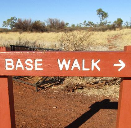
| We saw only a few other people as we made the circuit, so if you want to escape the crowds, the Base Walk is an easy and super-fun way to do it |
| | | | | | |
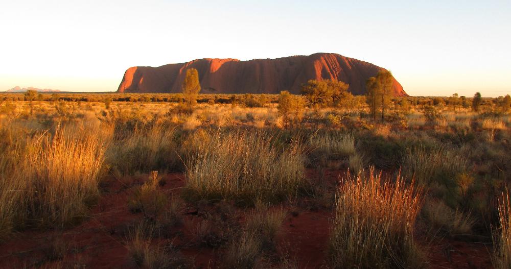
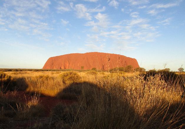
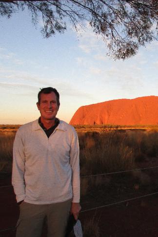
| The view we came all this way for! Uluru as seen from the Sunset Viewing Area. |
| Uluru (Ayers Rock), Australia |
After driving 4½ hours from Alice Springs we
got settled into our room at Lost Camel Resort
then drove to the Sunset Viewing Area about
twenty minutes down the road. First we had to
pay 25 AUD (~$17.50) each for a three-day pass
at the entry station, then we could continue to
the Viewing Area. Here is where you'll get those
killer views of Uluru you've seen on postcards!
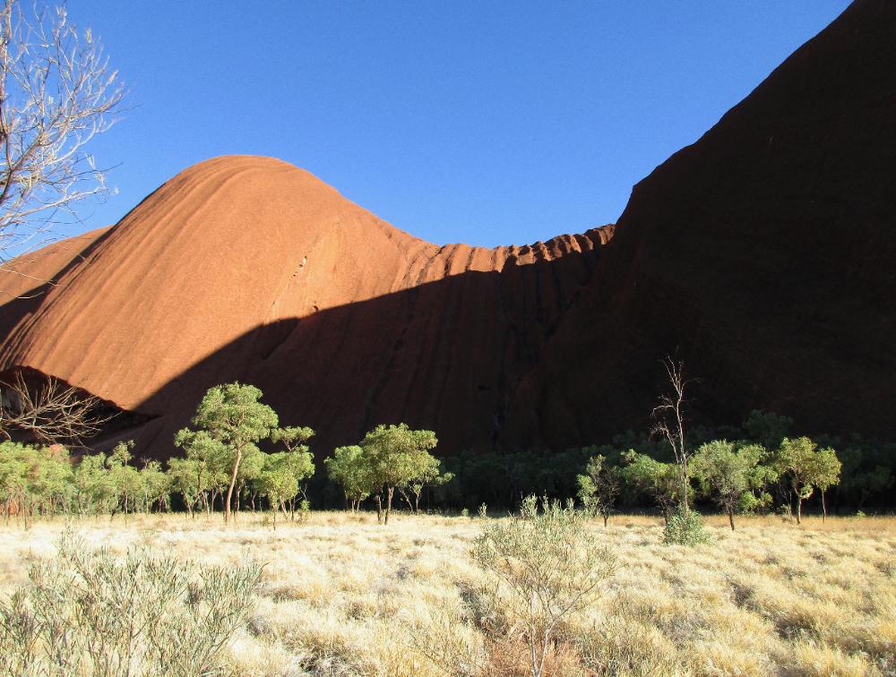
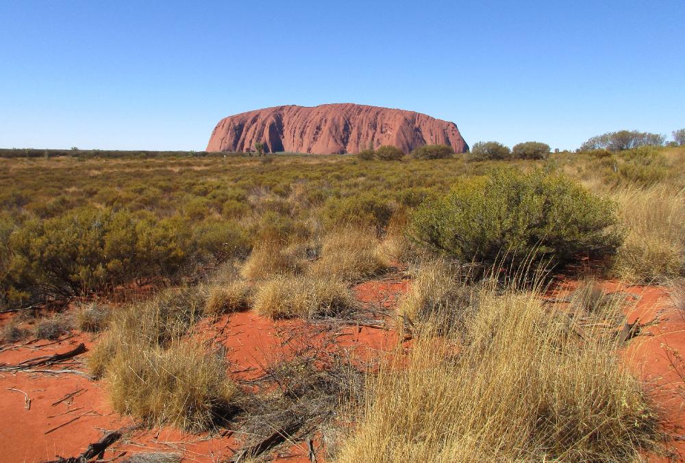
But there's more to Uluru than just one view.
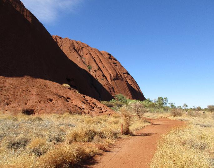
The best way to see this "island mountain" well
is to do the Base Walk all the way around it. We
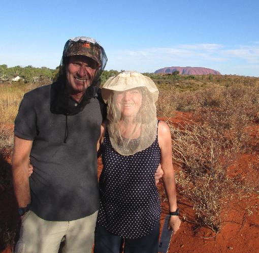
highly recommend this -- but go early when it's
still cool and the flies are inactive: you'll have a
much better time. Making a circuit lets you see
Uluru up close from many different and frankly
surprising angles. The whole circuit is 10.6 km
(6½ miles) long and almost completely flat.
We combined the Base Walk with two easy
add-ons known as the Mala and Kuniya Walks.
Each is only about 1 km (½ mile) each way and
lets you get even closer to Uluru -- and see
some of the areas most sacred to the Anangu.
Aborigines once again own the site and jointly
manage it with Australia's National Parks system.
got settled into our room at Lost Camel Resort
then drove to the Sunset Viewing Area about
twenty minutes down the road. First we had to
pay 25 AUD (~$17.50) each for a three-day pass
at the entry station, then we could continue to
the Viewing Area. Here is where you'll get those
killer views of Uluru you've seen on postcards!
But there's more to Uluru than just one view.
The best way to see this "island mountain" well
is to do the Base Walk all the way around it. We
highly recommend this -- but go early when it's
still cool and the flies are inactive: you'll have a
much better time. Making a circuit lets you see
Uluru up close from many different and frankly
surprising angles. The whole circuit is 10.6 km
(6½ miles) long and almost completely flat.
We combined the Base Walk with two easy
add-ons known as the Mala and Kuniya Walks.
Each is only about 1 km (½ mile) each way and
lets you get even closer to Uluru -- and see
some of the areas most sacred to the Anangu.
Aborigines once again own the site and jointly
manage it with Australia's National Parks system.
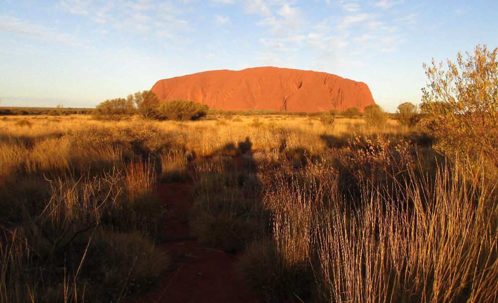
| Getting up early makes such a difference! At 7:30 am the lighting was terrific. |
| As we followed the Kuniya Walk closer in towards Uluru, signs made clear how spiritually important this area is and always has been to the Anangu (the local Aborigines) |
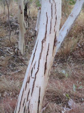
| This area has a lot of river red gums, a lovely white-bark eucalyptus tree endemic to Australia |
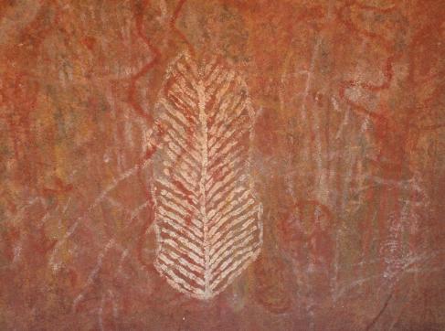
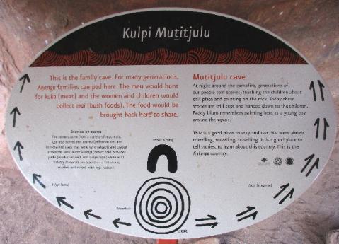
| Also nearby is the Family Cave where generations of Anangu families lived, told stories, painted on the cave walls, and taught their children the significance of the place |
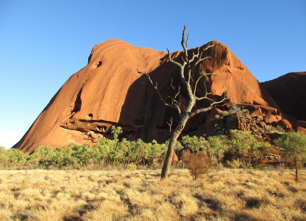
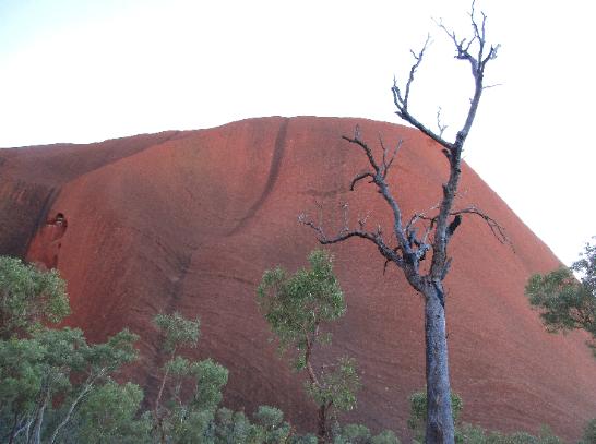
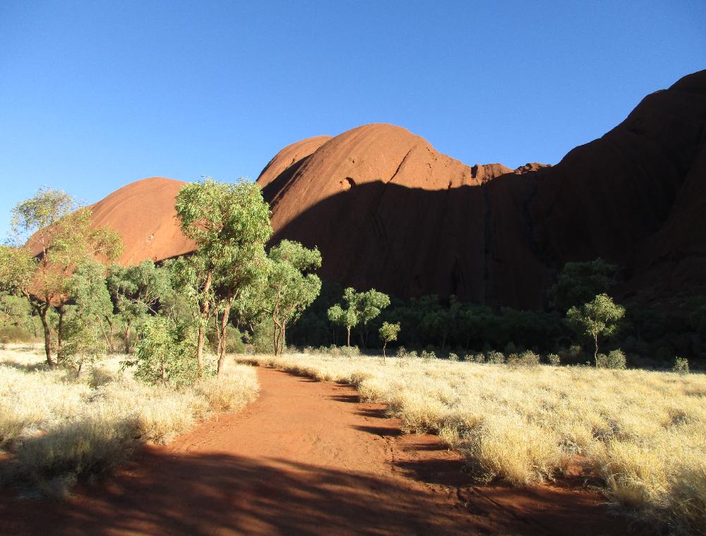
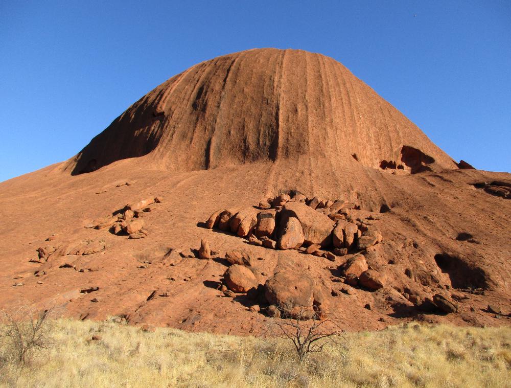
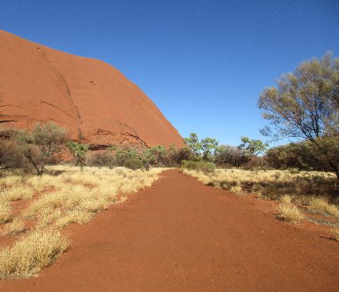
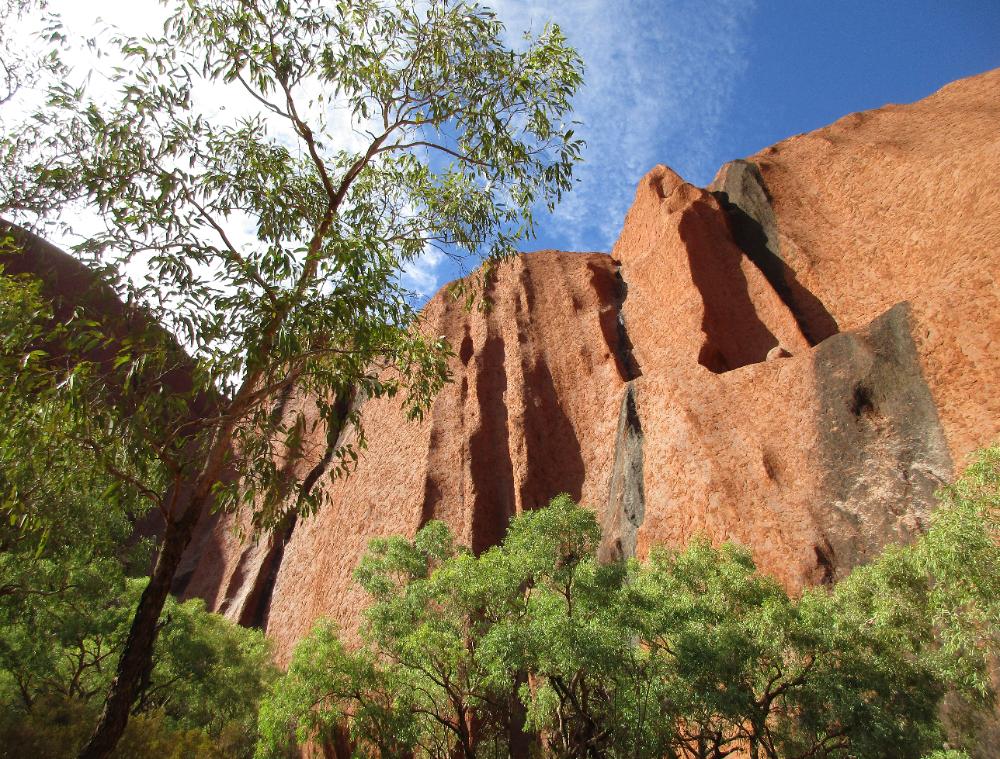
| You'll see so many different aspects of Uluru as you make your way around. What looks like one uniform mass of rock from a distance has a lot of individual personality up close. |
| It's very easy to do the Kuniya Walk then transition into doing the Base Walk. We went counter-clockwise but took many photos (like this one) looking back. |
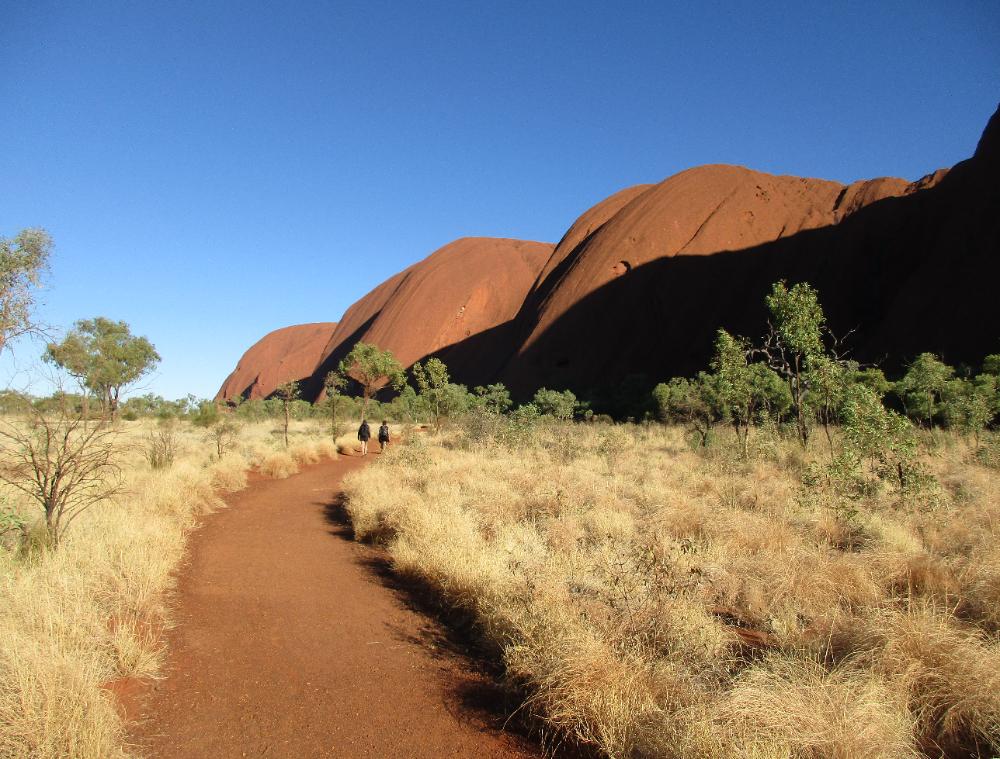
| The trail is unmissable and flat -- and there are even one or two water stations along the route |
| While there are a few areas where the Anangu request you don't take photos, most of Uluru is fair game for your camera |
| The whole circuit only took us 2½ hours total -- plus another hour or so for the add-on Kuniya and Mala Walks |
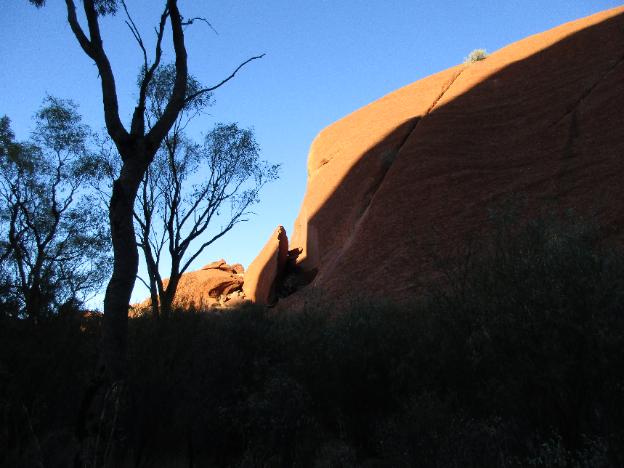
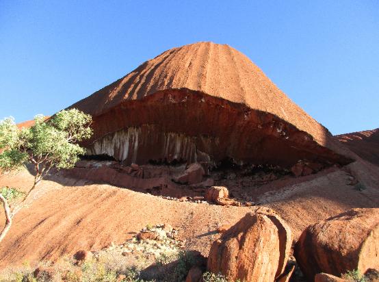
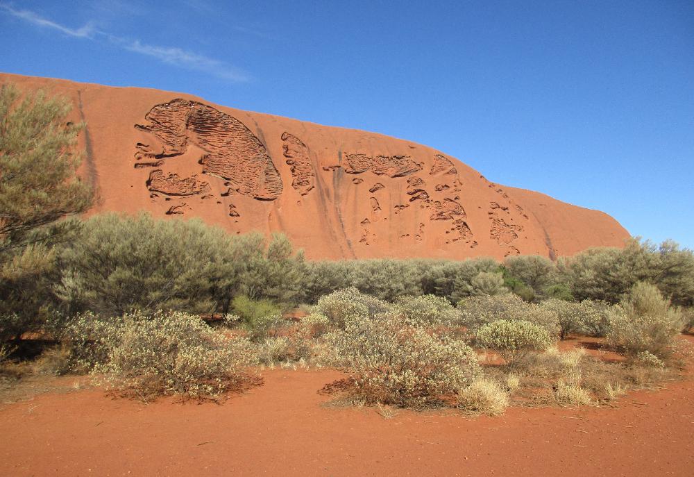
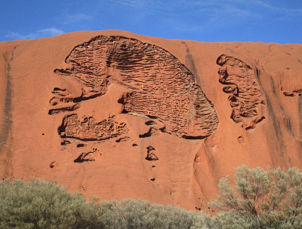
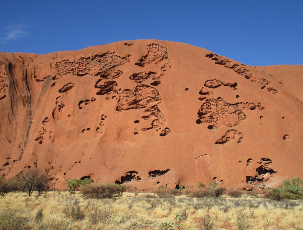
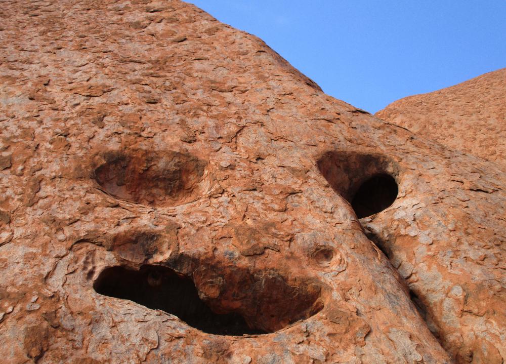
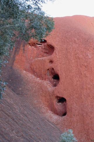
| Just past the Kuniya Piti water station and rest stop, we were blown away by some of the strangely eroded rock on the "back side" of Uluru |
| The eroded rock to the left looks a whole lot like a human cranium to our eyes! |
| We found ourselves wondering whether some commonly repeated Aboriginal motifs can be traced back to "natural art carvings" like these |
| About two-thirds of the way around the Base Walk, we made a short detour to do the Mala Walk |
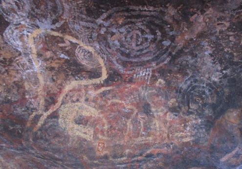
| In the Teaching Cave, elders taught young boys how to travel the land and survive, using the cave walls like a blackboard to teach their lessons |
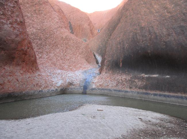
| This is another area of great significance to the Aborigines. At the end of the walk is Kantju Gorge, a sacred waterhole. |
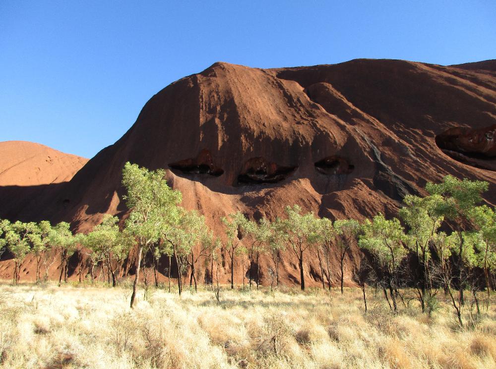
| Up close you can see that the sandstone that makes up Uluru is pockmarked and fractured and chipped a thousand times over |
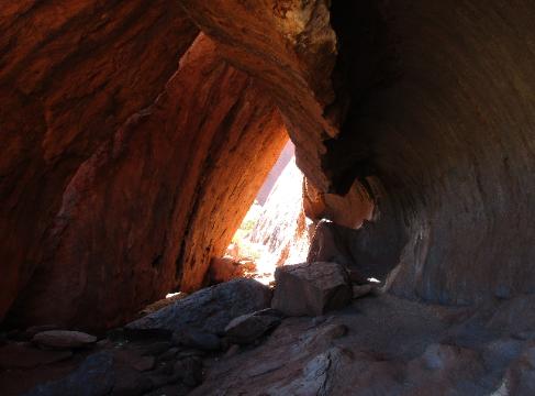
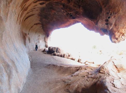
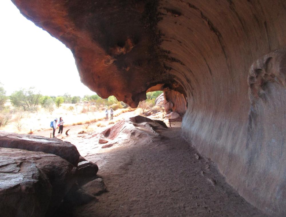
| Kitchen Cave looks like a curling wave about to break on shore |
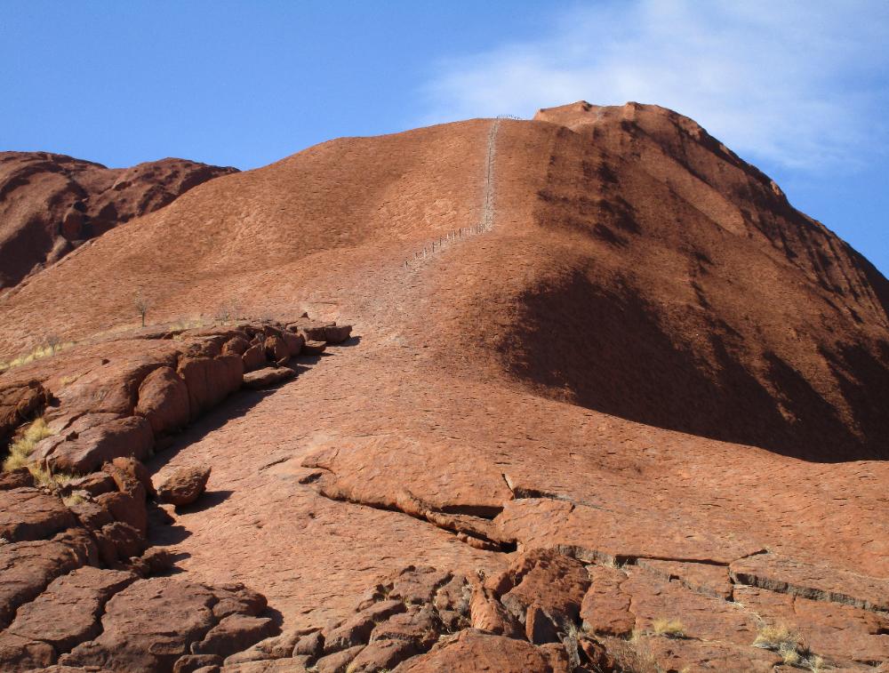
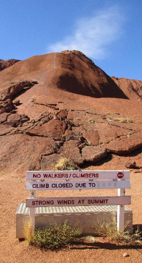
| For those who want to climb Uluru, this has been the traditional route -- but as of 26 October 2019 climbing Uluru is officially prohibited |
| We made one final stop on the way home. This is the Sunset Viewing Area for buses -- but cars can visit before 4 pm each day. Not a bad way to finish up. |
| THAT'S Uluru as seen from a distance at Imalung Lookout within Ayers Rock Resort |
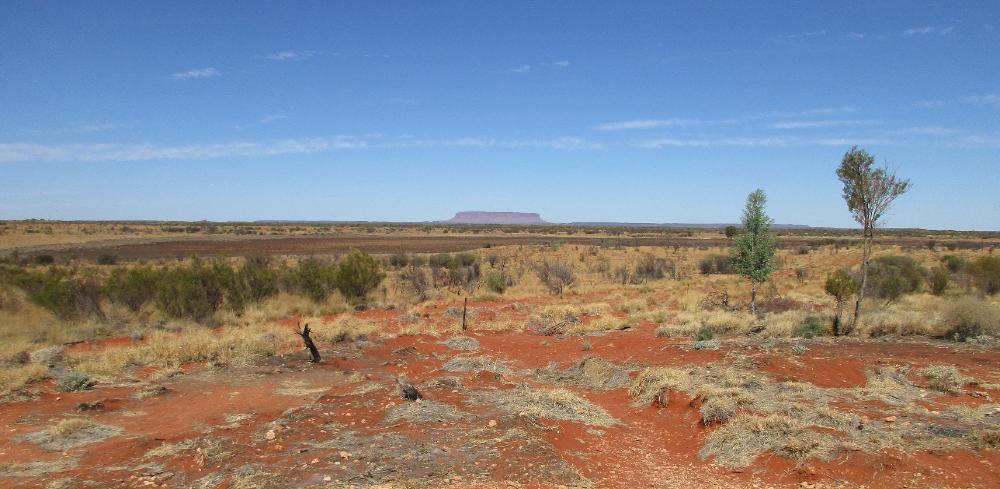
| This is NOT Uluru! But we thought it was at first and got quite excited. False alarm! This is Mount Conner as seen from a roadside lookout -- still a good 80 miles (130 km) from Uluru. |
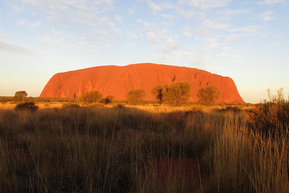
| No doubt this view is seared into your brain from a million different photos so we'll keep it to just a few images -- but wow! In person, just wow! |
| It really does glow reddish-orange at sunset (6:17 pm when we visited). And while it's hard to believe, most of Uluru's bulk lies underground! |
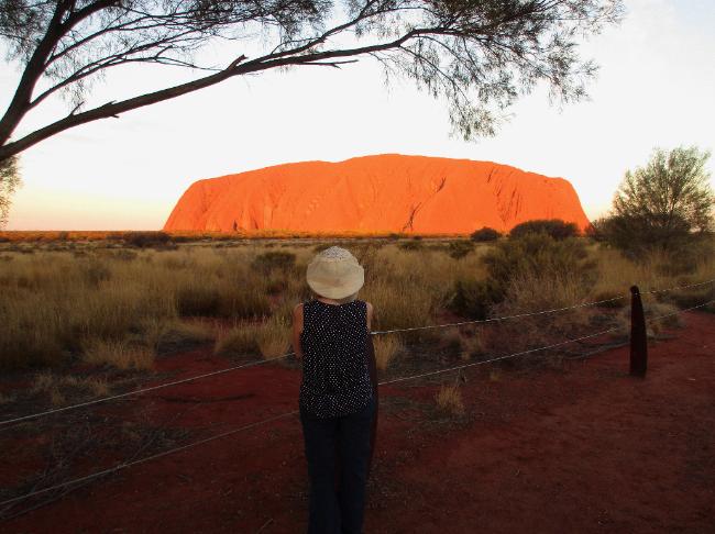
| Uluru turned redder and redder right up until the end -- then we drove back at full dusk in a cavalcade of cars |
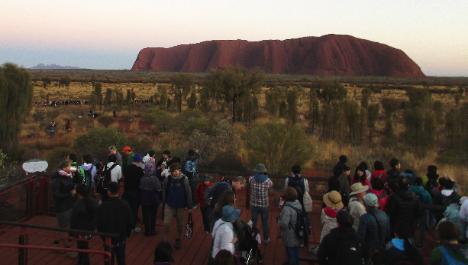
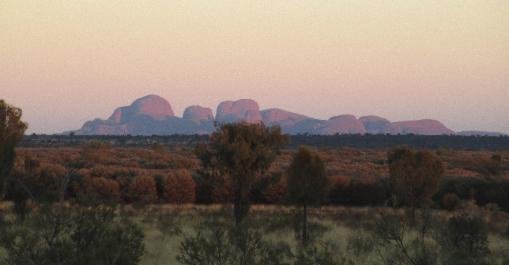
| At 6:30 am we joined another cavalcade of cars driving in darkness to the Sunrise Lookout half an hour away. Actual sunrise was at 7:10 am. As you can see we had plenty of company on the viewing platform. The photo at right shows the more distant Kata Tjuta range (also barely visible in the photo at left). |
| The sunrise side of Uluru is more crenellated so you don’t get the whole rock glowing reddish-orange like you do at sunset. Still, it’s beautiful and worth getting up early for. |
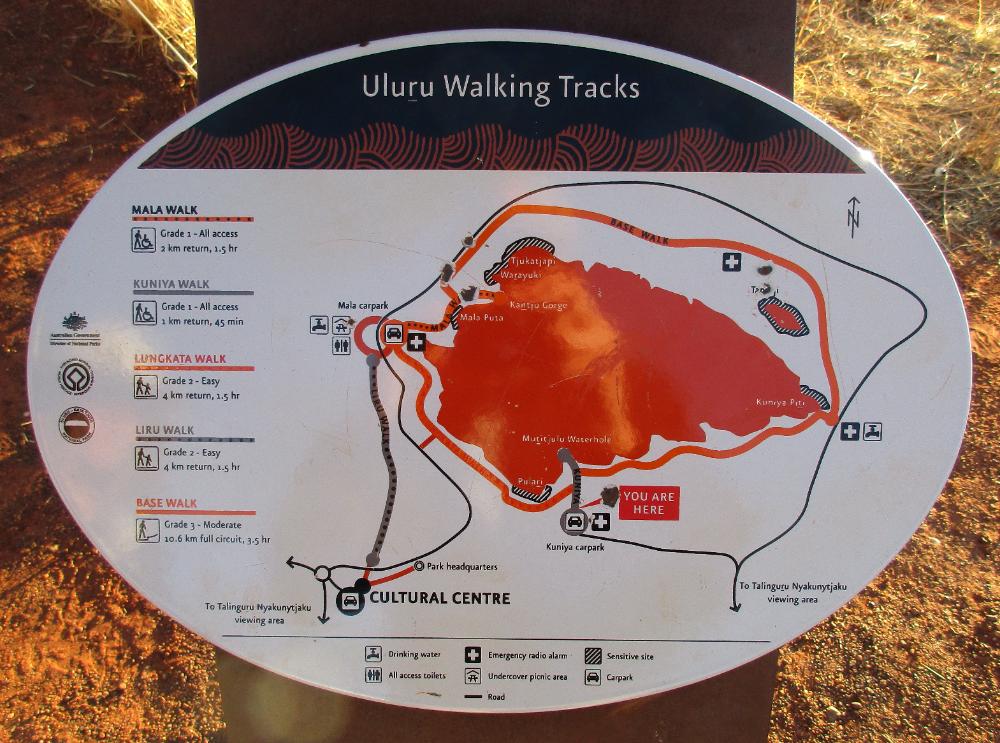
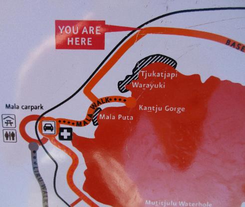
| This placard gives a good overview of the hiking possibilities around Uluru. "You Are Here" indicates we started our walk at the Kuniya carpark (a little less busy than Mala carpark). |
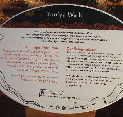
| The Kuniya Walk leads to the peaceful Mutijulu waterhole. Nearby are scars said to be from a deadly battle between two ancestral beings. |
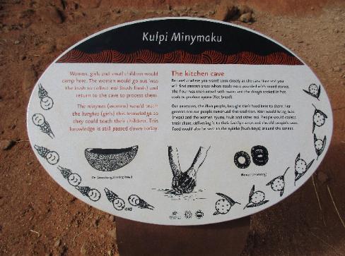
| Last but not least is the Kitchen Cave, a huge space where women, girls, and small children would camp and prepare food |
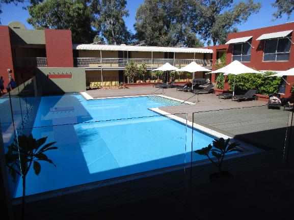
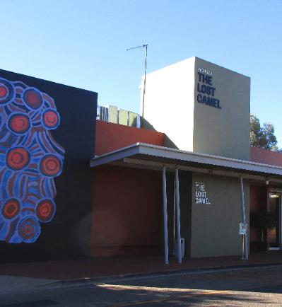
| We stayed at the Lost Camel Hotel at Ayers Rock Resort (aka Yulara) -- a 30-minute drive from Uluru itself. The price may seem high at $182 US per night but that's pretty cheap for the area (unless you're camping). |
| Sunset Viewing Area |
| Sunrise Viewing Area |
| Kuniya Walk |
| Base Walk |
| This is said to be the site of significant battles between good and evil during the "Tjukurpa" (Creation Time) |
| Mala Walk |
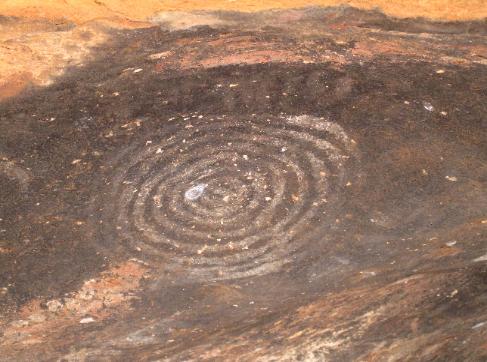
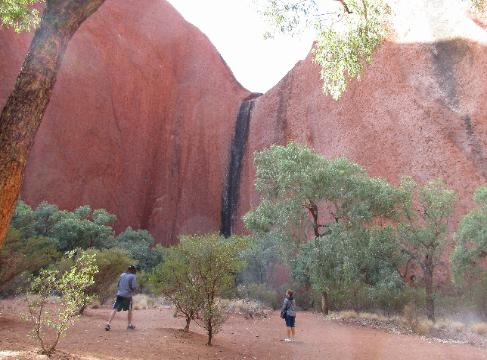
| At Kantju Gorge you can see black watermarks where temporary watefalls cascade over the cliff face |
| Nearby is the Men's Cave where the elders camped while the younger boys learned to hunt |
| Base Walk (Final Third) |
| We had already decided not to climb it out of respect -- but the route was closed anyway |
| We finished out the final third of the Base Walk and happily collapsed into our car at Kuniya Carpark |
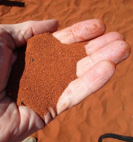
| If you've ever wondered if the Red Centre is really all that red, the answer is yes! |
| Bus Sunset Viewing Area |