
Where We Be
 | |  | |  | |  | |  | |  | |  |


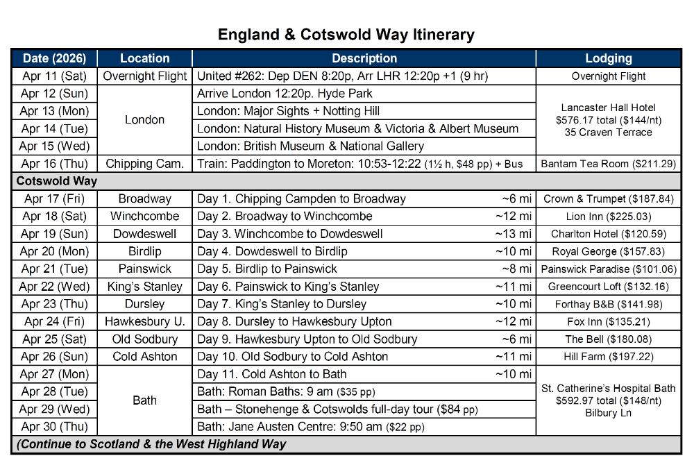
| Cotswold Way -- Map & Itinerary |
The Cotswold Way is a 102-mile walk from one
quaint town to another in the Cotswolds of
England. It is usually hiked from north to south,
beginning in the town of Chipping Campden
and ending in the city of Bath.
How to Get There: Multiple trains per day leave
from Paddington Station to Moreton-in-Marsh,
the closest town to Chipping Campden by train.
The journey takes about 1½ hours. Take the
Line 1 bus from the “Corn Exchange” gift shop
in Moreton-in-Marsh to Chipping Campden. You
can pay on the bus by tapping your credit card.
If you miss the bus (like we did), consider taking
an Uber instead -- it's a relatively short distance.
Railcards: If you plan to do a lot of train travel in
England, consider getting a UK railcard. We
purchased two Senior Railcards offering 34% off
for those age 60 and over (there are other
versions too). It's good for 1 year and works for
overseas visitors. Download the UK railcard
app to your phone, store the railcards there,
and simply show them to a conductor if asked.
quaint town to another in the Cotswolds of
England. It is usually hiked from north to south,
beginning in the town of Chipping Campden
and ending in the city of Bath.
How to Get There: Multiple trains per day leave
from Paddington Station to Moreton-in-Marsh,
the closest town to Chipping Campden by train.
The journey takes about 1½ hours. Take the
Line 1 bus from the “Corn Exchange” gift shop
in Moreton-in-Marsh to Chipping Campden. You
can pay on the bus by tapping your credit card.
If you miss the bus (like we did), consider taking
an Uber instead -- it's a relatively short distance.
Railcards: If you plan to do a lot of train travel in
England, consider getting a UK railcard. We
purchased two Senior Railcards offering 34% off
for those age 60 and over (there are other
versions too). It's good for 1 year and works for
overseas visitors. Download the UK railcard
app to your phone, store the railcards there,
and simply show them to a conductor if asked.
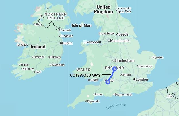
| This map shows where the Cotswold Way is in relation to London and England as a whole |
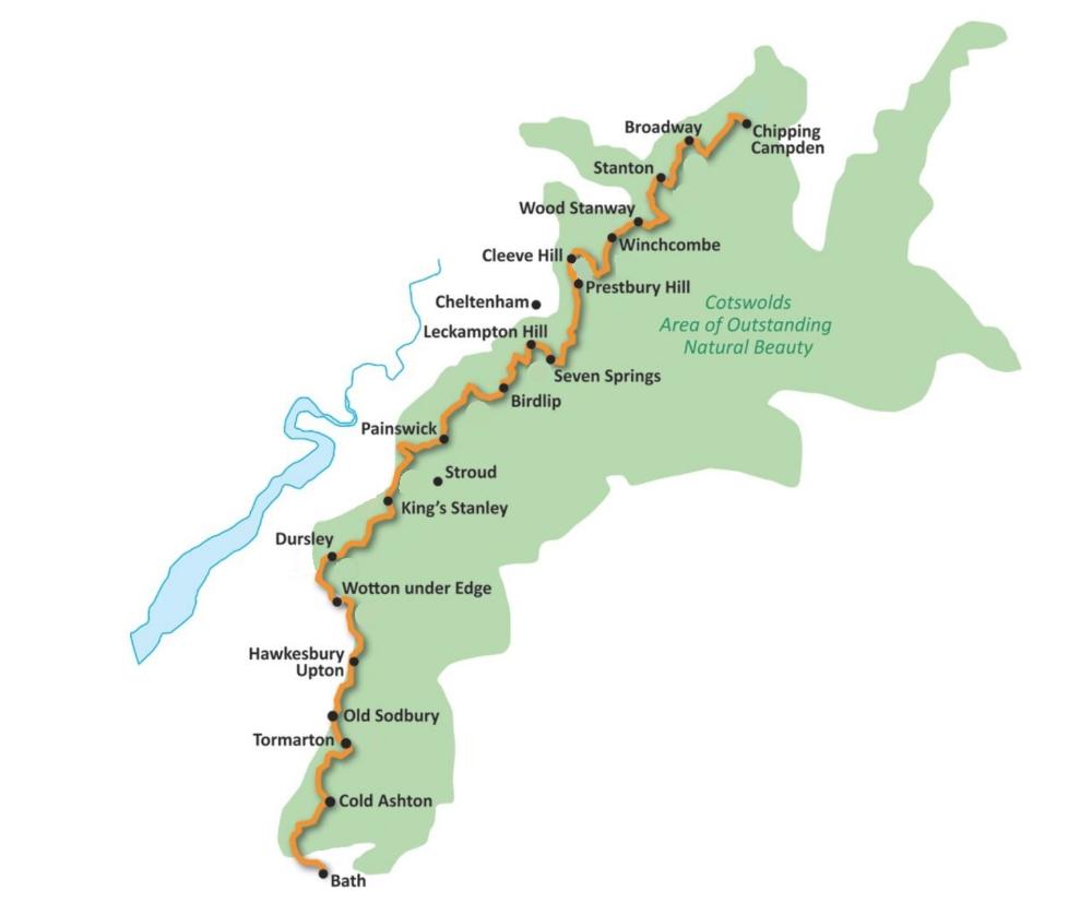
| Cotswold Way: Detailed Map |
| This map zooms in on the actual route of the Cotswold Way, showing the names of towns and villages along the way |
| Map Data 2026 Google |